


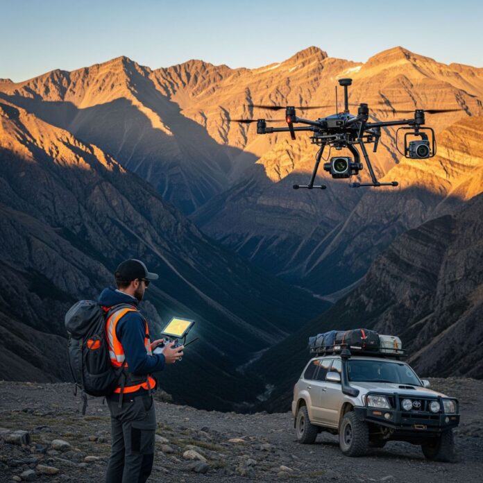
The use of drones in geological surveys are transforming modern industry, providing previously unsuspected accuracy and safety in data collection in the field. This technological innovation allows geologists to map hard-to-reach areas with high resolution, cutting analysis time from weeks to hours.
Technical profile of UAV technologies in geology
The integration of unmanned aerial vehicles (BLA) in the geosciences is not simply a matter of aerial photography, a complex process on remote monitoring. At the heart of this technology is the ability of drones to carry specialized sensors, which record electromagnetic spectra, invisible to the human eye. The main methods, that change the rules of the game, with photogrammetry And LiDAR (Light Detection and Ranging) the scan.
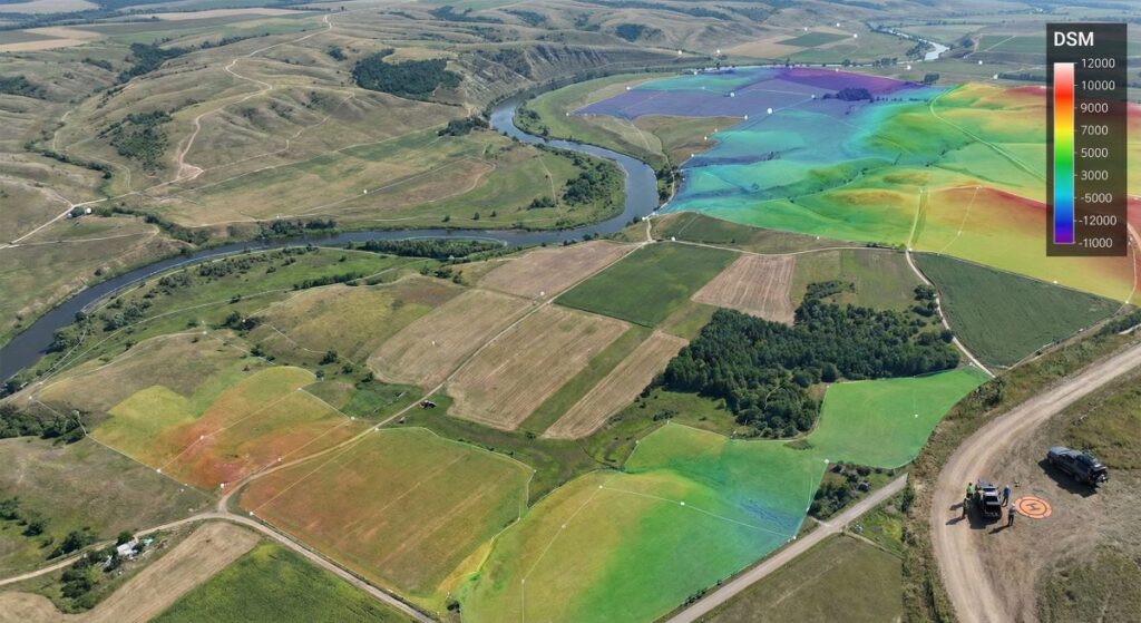
In photogrammetry, the drone captures hundreds of overlapping high-resolution images. These images are processed using specialized software, to create orthomosaic And digital surface models (DSM). This allows experts to perform precise volume measurements, faults and geomorphological structures with centimeter accuracy.
On the other hand, LiDAR sensors send laser pulses to the earth's surface, which can penetrate even through dense vegetation. This method is invaluable in geological surveys in forest areas, as it allows the generation of a "goal" digital model of the relief (DTM), revealing hidden geological structures, terraces or anthropogenic changes, which would go unnoticed by traditional methods.
Magnetometry and geophysical surveys from the air
One of the most innovative applications of modern drones in geological surveys is the mounting of highly sensitive magnetometry. Traditionally, magnetic measurements were made either by ground crews, walking on difficult routes, or via expensive helicopter missions. Today, UAV platforms offer “the golden mean” – they fly at low altitude, providing extremely high data density.
Geophysical data, collected by drones, help identify magnetic anomalies, which are often an indicator of the presence of metallic minerals such as iron ore, copper or gold. Thanks to flight stability and the possibility of automated terrain following (terrain following), noise in the data is minimized, leading to a more accurate interpretation of the subsurface structure.
Besides magnetometry, are also starting to enter the sector hyperspectral cameras. They analyze the chemical composition of the rocks by the reflected light, allowing directly mineralogical mapping from the air. This dramatically reduces the need for physical sampling in the early stages of the survey, keeping the environment intact.
Global market and context of the mining industry
Globally, the sector of drones in geological surveys is undergoing rapid growth. According to the latest market analysis, the use of unmanned technologies in the mining industry has increased by over 40% in the last five years. Leaders in this direction are regions such as Australia, Canada and Chile, where the sheer scale of mining sites makes ground surveying cost-effective.
Compared to traditional methods, using manned aircraft, drones offer up to 90% lower mission costs. This democratizes access to high-quality geological data, allowing even smaller exploration companies to compete with industry giants. In addition, in the context of sustainable development, drones have a minimal carbon footprint compared to kerosene helicopter engines.
The European context is also changing. With the new regulations of EASA (European Aviation Safety Agency), the implementation of drones in geological surveys it becomes easier and more transparent. Bulgaria, with its rich mining history and developed technology sector, has the potential to become a regional hub for geospatial data processing, collected by UAVs.
The future: AI integration and autonomous swarms
The analysis of the future (Future Outlook) for the next ones 10 years points to complete process autonomy. We await the entry of artificial intelligence (AI), който ще обработва данните в реално време още на борда на дрона. Вместо да чакаме края на полета, за да свалим информацията, алгоритмите за машинно обучение will identify prospective areas for mineralization while still in the air.
Another exciting trend are the so-called. “swarms of drones”. A group of several small devices, coordinated with each other, will be able to cover thousands of hectares in a matter of hours, with each drone carrying a different type of sensor – one for magnetometry, another for photogrammetry, third for gas analysis. This will create multi-layered digital counterparts of the deposits with unprecedented detail.
The risks in the future will be mainly related to cyber security and industrial data protection. Because geological information is of strategic importance, companies will have to invest heavily in encrypting the connection between the drone and the ground station. However, the potential to discover new ones “critical raw materials”, necessary for the green transition, far exceeds these challenges.
Socio-economic dimension and ecological effect
The implementation of drones in geological surveys has a direct positive impact on occupational safety. Geology often requires working in dangerous terrain - steep slopes, unstable quarries or wilderness areas. Drones eliminate the need for humans to put themselves at risk, doing the most dangerous part of the job remotely.
From an economic point of view, digitalization through drones creates new jobs for specialists in GIS (Geographic information systems) and geological profile UAV pilots. It is a transformation of the workforce from low-skilled physical labor to high-tech intellectual analysis. The industry is becoming more attractive to young professionals, who seek innovation in conservative sectors.
Environmental protection is also a key factor. Precise mapping allows mining companies to plan their operations with surgical precision, minimizing disturbance to the landscape. The monitoring of reclamation through drones guarantees, that the restoration of nature after the end of mining activities is carried out correctly and according to environmental standards.
Advances in geosciences are already flying high and it is time to embrace these opportunities for a more efficient and green industry.
The future of Bulgarian geology is digital, and we from Geotopia.bg we will continue to follow every step of this exciting technology trajectory.